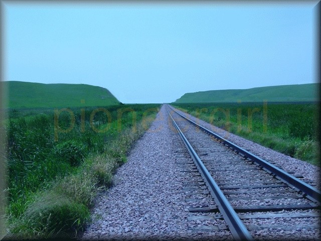
railroad cut / fill

cut. A notch, passage, or channel made by cutting; a furrow; a groove. The surface left by a cut. — Webster, 1882
cut and fill. The process of removal and/or addition of materials to an existing natural earth contour in order to create a level railroad bed.
 Those bothersome Minnesota cuts are jammed full of snow again and hence the iron horse from the east has not put in an appearance for 4 – 5 days. – Iroquois Herald, February 1884
 Railroad cuts and fills are described in detail — too much detail for some readers who routinely skip the section — in By the Shores of Silver Lake (see Chapter 10, “The Wonderful Afternoon”). In a letter to daughter Rose Wilder Lane, Laura Ingalls Wilder explained that the story was fictionalized as if Laura had gone to see the work with Pa, adding that she would never have been allowed to do so. The section serves to show that even though the train is a marvelous machine, men and horses and plows have a great deal of earth-work to do prior to its arrival and use.
 Cut and Fill. A train ran most efficiently when going downhill, but running on level ground was the next best thing. Unfortunately, the “flat” prairie of eastern Dakota Territory also contained rolling hills. Surveyors determined the best route for the rails to be laid, based on many factors, including the natural contours of the land, composition of soil, location of bodies of water, and the cost of labor and materials involved to do the work.
Earth would have to be removed (cut) or added (fill) in order to create this level track bed. Note that in both drawings, the natural contour of the land is the same. In the CUT drawing above right, the earth has been removed for the desired roadbed. In the FILL drawing at left, earth has been added to the existing contour in order to create a raised roadbed.
Here’s something interesting. While the above drawings show a cut or fill for tracks running parallel to a slope, the drawing below is a tiny piece of the railroad surveyor’s map of the C&NW RR track (the red line) between De Smet and the beginning of Big Slough to the east. (You didn’t think I was going to share the whole thing, did you?) Trackbed is in red and cuts and fills are in yellow (by me). The original has a faint red line for railroad bed – it didn’t show up very well in the photo – but the pencil lines showing cuts and fills are still quite bold.

Cut West of De Smet. In her Pioneer Girl memoir, telling the story of the railroad Superintendent stopping work on digging out the tracks during the winter of 1880-1881 (see The Long Winter, Chapter 21, “The Hard Winter”), Laura Ingalls Wilder mentioned a cut “just west of De Smet” in which the snow lay 25 feet deep at the same time it was one hundred feet deep on the track at the Tracy cut. It is unclear where this may have been, but in the early 1900s, the road 4 miles west of De Smet between De Smet and Manchester was rerouted in the northwest corner of 36-111-57. This was before Highway 14 was constructed, and the existing road crossed the railroad tracks at the west end of a deep cut, which was said to fill with snow in the winter and make crossings almost impossible. Driving west on Highway 14 today, it’s hard to imagine any deep cuts in the area, but this spot is located just where the road turns south between 430th Avenue and 429th Avenue, when driving west. The original road was north of the tracks at this point, not south of them. This area was still problematic to trains heading east into De Smet as late as the winter of 1935-1936. In 1977 there was a ten-car derailment in this vicinity. The following winter, a train became lodged in a deep drift a little closer to De Smet. When I visited De Smet during the winter of 2011, there were dozens and dozens of railroad cars stranded on the tracks because some cuts had filled with snow!

cut (SSL 10; TLW 11, 21, 25, 31; PG)
big cut / Big Tracy Cut (TLW 11, 14-16, 18-19, 21, 31; PG), see Big Tracy Cut
cut and fill (SSL 10; PG)
cut west of De Smet (PG)
fills (PG)

